Manuscripts
Rancho Cañada de los Nogales, with parcels in sec.s 19 & 30, T.1 S.R.13 W., and sec. 25, T.1 S.R.14 W. S.B.M

You might also be interested in
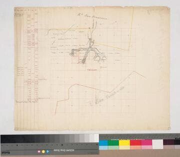
Rancho San Francisco: parcels beyond southern boundary in sec. 4-11, 14-17, T.3N. R.16W. S.B.M
Manuscripts
Rancho San Fernando to the south Indicates names of owners, surface detail in hachures; waterways; color highlights On printed township grid; table with courses & boundary data. Title supplied by cataloger.
mssSolano SR_Map_0145

Rancho los Coyotes: township map showing parcels and owners in sec.s 16 & 36, T.4S. R.11W. S.B.M
Manuscripts
On printed township grid: T.4S. R.11W.. 36 sections w/ color highlights of landowners J. Belly, J. Shumacher & Co., M. Keller, A. Labory. Title supplied by cataloger.
mssSolano SR_Map_0051
Image not available
[Rancho Cañada de los Nogales, with parcels in sec.s 19 & 30, T.1S. R.13W., and sec. 25, T.1S. R.14W. S.B.M.]
Manuscripts
The collection consists of maps, field books, legal documents, business papers, and diaries related to the work of surveyors George Hansen, Alfred Solano, Sidney B. Reeve, and others. The maps and surveys in the collection are of the city of Los Angeles, Southern California ranchos, and subdivisions of the city of Los Angeles and neighboring towns. The collection contains over maps and sketch maps. Other subjects represented in the collection include: civil engineering, land subdivision, mines and mineral resources, and daily life in Los Angeles and Los Angeles County.
mssSolano

Labory, Huart, and Elisalde parcels, sec. 29-32, T.1S. R.12W., and sec. 25, T.1S. R.13W. S.B.M
Manuscripts
Western border: Eastern Limits of the City of Los Angeles. San Gabriel Mission lands. Survey requested by A. Labory. Parcels highlighted in color; Arroyo de Rosa Castilla or de los Alisos indicated; pencil annotation on verso. Title supplied by cataloger.
mssSolano SR_Map_0151

Sketch map of Rancho Cañón de Santa Ana, sec.s 21-23, 26-28, 33-35, T.3S. R. 9W. and sec.s 2-4, T.4S. R.9W. S.B.M
Manuscripts
T.3 S. R.9 W. S.B.M.. Hachures mid-grid with waterway at southern boundary [Santa Ana River) south of this river would be Rancho Santiago de Santa Ana]. Hachures Title supplied by cataloger.
mssSolano SR_Map_0036

Parcel map Township 1 South Range 12 West San Bernardino Meridian
Manuscripts
Bordered by parts of Ranchos San Pascual, San Rafael, Potrero Grande, San Antonio, La Merced. San Gabriel Mission lands: detailed parcel map: coordinates, acreage; hachures for land features, color highlights; inset with table - meanders of the Arroyo Seco. Copied by Alfred Solano. Title supplied by cataloger.
mssSolano SR_Map_0153.01