Manuscripts
Map of the Francisco Abila Tract, part of Januario Abila Tract in the Rancho La Cienega

You might also be interested in

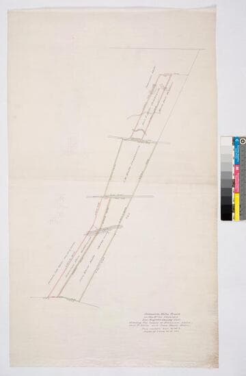
Januario Abila Tract partition
Manuscripts
Within bound document: "Rancho La Cienega, Januario Abila Tract 855 acres. Partition 1866..." two versions of parcel map showing parcel owners, courses, distances - first version with color highlights, second version show Pico extension, more notations, calculations. Alt. title supplied by cataloger.
mssSolano SR_Box_21(04).01
Januario Abila Tract
Manuscripts
Other Abila [Avila] family landholders shown, as well as Molle, Dore, Cox. Ballona Road indicated. Color highlights; hachures; var. 14° 45' E Alternate title supplied by cataloger.
mssSolano SR_Map_0045

Rancho las Ciénegas : S59 - Plat of the Rancho la Cienega finally confirmed to Anuario sic Abila et al
Manuscripts
Bordered by public lands, Ranchos La Cienega y La Tijera, Rodeo de las Aguas, La Brea. Within bound document, "Rancho La Cienega Partition... Henry H. Gird et al vs. Januario Abila et al..." copy certified by numerous officials; with color highlighting, surface details, table with boundary data, courses, distances, section numbers, markers. Title supplied by cataloger.
mssSolano SR_Box_21(04).06
Image not available
Rancho las Ciénegas: S59 - sketch maps
Manuscripts
Maps within document, "Rancho La Cienega, Tract of Januario Abila, partition of said tract... by Referees Mitchel, Baldwin & Hansen..." mostly pencil, some ink, with courses & distances. Title supplied by cataloger.
mssSolano SR_Box_21(04)