Manuscripts
Consuelo subdivision of the Celis Vineyard Tract

You might also be interested in

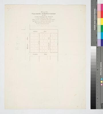
Consuelo subdivision of the Celis Vineyard Tract
Manuscripts
Pine to Celis St., Main St. to east of Carlisle St.; courses, distances, parcel numbers. Survey requested by F. de Celis. Pencil calculations, annotations. Alt title supplied by cataloger.
mssSolano SR_Map_0565.02
Consuelo subdivision of the Celis Vineyard Tract
Manuscripts
Pine to Celis St., Main St. to east of Carlisle St.; courses, distances, parcel numbers. Survey requested by F. de Celis. Alt title supplied by cataloger.
mssSolano SR_Map_0565.01
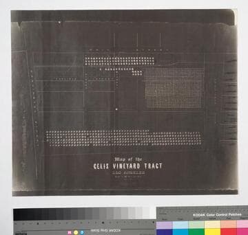
Celis Vineyard Tract
Manuscripts
Washington and Main St., showing trees and proposed [Mills'] subdivisions, dated 1855-1871; parcel owners; Carlisle, Celis & Pine Streets. Alt title supplied by cataloger.
mssSolano SR_Map_0406

Map of the Josefa Subdivision of the Celis Vineyard Tract
Manuscripts
Laurel to East Pico St., from Main St. to Maple Ave.. Courses, distances, calculations & parcel numbers in pencil. Pastor de Celis now Mills Subdivision. [Title info from verso]. Alt title supplied by cataloger.
mssSolano SR_Map_0647.01
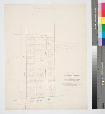
Map of the Consuelo & Brodrick subdivisions of the Celis Vineyard Tract
Manuscripts
Surveyed at the request of F. de Celis and W.J. Brodrick. Consuelo subdivision is crossed out in pencil with notation re: Dec 1882 change. Color highlighting; courses, distances, calculations. Alt title supplied by cataloger.
mssSolano SR_Map_0565.06
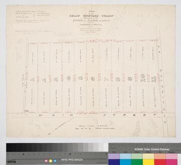
Celis Vineyard Tract
Manuscripts
Northeast of Main & Washington St., Subdivision of partition of Aug. 4th 1877 per Pedro de Celis et al vs. Pastor de Celis. Parcels are numbered (red & black ink) with owners indicated; distances, acreage. Pencil notations & calculations. Alt title supplied by cataloger.
mssSolano SR_Map_0473.01