Manuscripts
Craig, James (Ranchos San Pascual and Santa Anita); sketch maps

You might also be interested in

Craig, James (Ranchos San Pascual and Santa Anita) - sketch maps
Manuscripts
1st sketch (#4A) on verso of previous map on township grid, featuring sections 2-3 ; 2nd sketch (#4B) within document "Craig James, 79 Nov. 21..." verso of 4th page in, show section numbers, courses, distances, acres. Title supplied by cataloger.
mssSolano SR_Box_27(24).04A

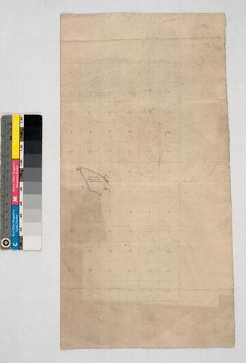
Craig, James (Ranchos San Pascual and Santa Anita) - survey of about 240 acres
Manuscripts
...to be sold by Craig to Hall ; Township 1 North, Range 12 W. on printed township grid . Title supplied by cataloger.
mssSolano SR_Box_27(24).03

Craig, James (Ranchos San Pascual and Santa Anita) - parts of Ranchos San Pascual & Santa Anita
Manuscripts
Inserted into document, "James Craig, Rancho San Pascual & Santa Anita..." fifth page in ; "Allen William" at top of page: showing courses, distances, section numbers . Title supplied by cataloger.
mssSolano SR_Box_27(24).02

Craig, James (Ranchos San Pascual and Santa Anita) - Craig parcel
Manuscripts
Inserted into document, "James Craig, Rancho San Pascual & Santa Anita..." after first page ; showing courses, distances, title history, acreage ; fences ; color highlighting. Title supplied by cataloger.
mssSolano SR_Box_27(24).01
Image not available
Craig, James (Ranchos San Pascual and Santa Anita)
Manuscripts
The collection consists of maps, field books, legal documents, business papers, and diaries related to the work of surveyors George Hansen, Alfred Solano, Sidney B. Reeve, and others. The maps and surveys in the collection are of the city of Los Angeles, Southern California ranchos, and subdivisions of the city of Los Angeles and neighboring towns. The collection contains over maps and sketch maps. Other subjects represented in the collection include: civil engineering, land subdivision, mines and mineral resources, and daily life in Los Angeles and Los Angeles County.
mssSolano
Rancho Santa Eulalia : see also Rancho San Rafael
Manuscripts
[Atwater Village area]. On penciled township grid with section numbers, irregular shape; boundary in color: "Sa. Eulalia Lanc. Brent.". T.1N.-T.1S. R.11W. S.B.M.. 656 acres; minor surface details. Fern Sepulveda structure indicated. Title supplied by cataloger.
mssSolano SR_Map_0249