Visual Materials
Map of Mokelumne River Project
You might also be interested in
Image not available
Map of the Richmond Belt Railway and East Shore Co's property, Pt. Richmond, Contra Costa Co. Cal showing wharf of the Richmond Belt Railway Pt. San Pablo for loading direct from ship to car and track connections with the Southern Pacific & Santa Fe Railways with lower freight rates and better facilities than any other point on San Francisco Bay
Visual Materials
Old shelf number: eph J4-6(1). Dates based on years of operation of Richmond Belt Railway, from 1902-1932. An attempt to siphon traffic away from Oakland with apparently limited success. Submap: Map of part of San Francisco Bay showing relative position of East Shore Co's property. Prime meridian: GM. Relief: no. Graphic Scale: Feet. Projection: Cylindrical. Printing Process: Lithography. Verso Text: MS note: Eph J4-6(1).
ephMPCALIF0011
Image not available
Map of the City of Oakland, Berkeley, Oakland & Brooklyn Townships and Alameda
Rare Books
Detailed map of real estate in the East Bay. Half mile circles from central city. Sub map: Monterey to Napa Counties. "Lith. H. S. Crocker & Co." Relief: no. Graphic Scale: Miles. Projection: Plane. Printing Process: Lithography. Other Features: Sub-maps. Verso Text: MS note: Oakland.
150260
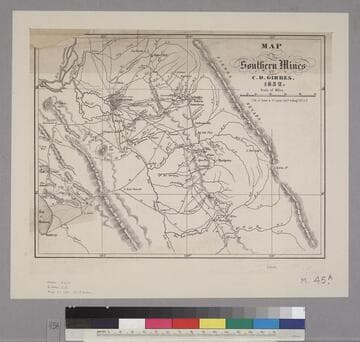
Map of the Southern Mines by Charles Drayton Gibbes
Rare Books
Image is of a map from Jackson, Mokelumne Hill, and Cosumnes River in the north to Ft. Washington and Lost Mt. in the south, and from the Bay of Monterey in the east to Sierra Nevada in the west. "Lith. of Quirot & Co. corner Calif. & Mong. Sts. S.F."--text, below title of the map. Paper color: buff.
48052:045a

Map of the Southern Mines by Charles Drayton Gibbes
Rare Books
Image is of a map from Jackson, Mokelumne Hill, and Cosumnes River in the north to Ft. Washington and Lost Mt. in the south, and from the Bay of Monterey in the east to Sierra Nevada in the west. "Lith. & Published by Quirot & Co. corner Montgomery & California Sts. S.F."--text, below image. "Noisy Carrier's Publishing Hall."--stamped text, below image. Paper color: blue.
48052:045
Image not available
Map of the lands of the College Homestead Association : situated on the Bernal Ranch near the St. Mary's College
Visual Materials
Old shelf number: eph J4-3 (3). This shows the first site of St. Mary's College of California: in 1889 the college moved across the bay to Oakland, and in 1928 it moved east again, to its current location in Moraga. Numerous notes with home owners names and property values. This area is now immediately south of Interstate 280. Marshall Street is now Maynard Street, and Lewis Street is now Trumbull Street. Note 50 ft. lots. MS note: 4.50 numerous others. Prime meridian: GM. Relief: no. Graphic Scale: Feet. Projection: Plane. Printing Process: Lithography. Verso Text: MS notes: College St. Mission Road S. of St. Mary's College.
ephMPCALIFT0032
Image not available
Louisiana Company's flume on the Mokelumne River
Visual Materials
View of flume, showing details, with tents in background in a canyon. Handwriting inside case, under plate, reads: "Louisiana Company's Flume on the Mokelumne River. Taken Oct. 1853. View of upper part of [__?] and all of the [Ramsbottom?] and a part of the [Minters? Bank?]." A list of names follows: "Capt. Birdsall, Boston; Capt. Bunker, Lowell; Demithy Reid, S.C.; Horatio Reynolds; H. E. Chesebrough & [Mathew?] Lightman; Luke Chesebrough; G. Shannon; Tom Thompson; Lorna; Shorb [C?] & Bell." In addition, another note inside the case reads: "Chesebrough's Flume, Maquilumne [sic] River, Calaveras Co. Cal. 1852, 1853 & 1854."
(photDAG 54)