Visual Materials
Map of power stations and transmission for the Edison Service Area

You might also be interested in

Map showing early transmission line corridors in southern California for Southern Sierras Power Co
Visual Materials
Map showing early transmission line corridors in southern California for Southern Sierras Power Co., Pacific Light & Power, and Southern California Edison.
photCL SCE 07 - 02447
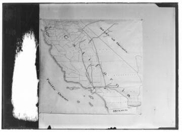
Map of Southern California showing the early transmission line corridors belonging to Pacific Light and Power, Southern California Edison and Southern Sierras Power Co
Visual Materials
Map of Southern California showing the early transmission line corridors belonging to Pacific Light and Power, Southern California Edison and Southern Sierras Power Co. before the time of Edison's acquisition of PL&P. No number originally assigned by Cal. Electric and - no documentation included.
photCL SCE 07 - 00036

A map of the transmission system of the Edison Electric Company
Visual Materials
A map of the transmission system of the Edison Electric Company, 1902.
photCL SCE 01 - 00789

Copy of transmission line map
Visual Materials
C1.3 - Maps - Copy of transmission line map. [Edison system]
photCL SCE 05 - 50309

C1.3 - Maps
Visual Materials
C1.3 - Maps - Map of entire Edison Service area [with transmission lines and generation sources from Big Creek and Kern River to southern California]
photCL SCE 02 - 04110

Two men working with a service area map
Visual Materials
Two men working with a service area map. - [with 3 variants]
photCL SCE 06 - 70809