Visual Materials
C1.3 - Maps - Outline map of Big Creek Territory (Dennis) showing cross-sections of tunnels at Big Creek

You might also be interested in

C1.3 - Maps
Visual Materials
C1.3 - Maps - Profile drawing of Big Creek facilities showing tunnels and pipelines.
photCL SCE 02 - 18019

C1.3 - Maps - Big Creek Project
Visual Materials
C1.3 - Maps - Big Creek Project - copy of Kaiser quad map.
photCL SCE 02 - 05409
C1.3 - Maps
Visual Materials
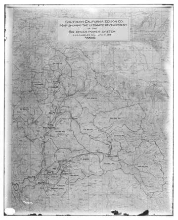
C1.3 - Maps - Map showing the ultimate development of the Big Creek Power System
photCL SCE 02 - 04874
C1.3 - Maps
Visual Materials
C1.3 - Maps - Map of Big Creek development showing Powerhouses 1, 2&2A, 8, and 3.
photCL SCE 02 - 13579

C1.3 - Maps - Map for the Big Creek project
Visual Materials
C1.3 - Maps - Map for the Big Creek project - Exhibit "B" for SCE's hydroelectric development on the San Joaquin River. Includes PH 6 and PH 7 which were never built..
photCL SCE 02 - 05451
C1.3 - Maps
Visual Materials
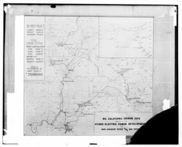
C1.3 - Maps - Barre combination map of the Big Creek project [showing projection for ultimate output and costs to build compared to existing (1922) output.]
photCL SCE 02 - 07450