Manuscripts
Mill-Seat of José Maffre & Augustin Poulain

You might also be interested in
Rancho Rodeo de las Aguas : external boundaries
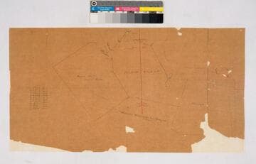
Manuscripts
Bordering Ranchos Rincon de los Bueyes, Cienega. Minor details: hachures, structures; red & blue ink. Inset with boundary data. Title supplied by cataloger.
mssSolano SR_Map_0163

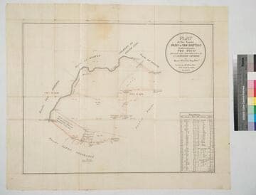
Plat of the Rancho Cienega o Paso de la Tijera confirmed to Tomas Sanchez
Manuscripts
Bordering Ranchos Rincon de los Bueyes, Sausal Redondo, La Cienega and public lands. Bound within document: "In the District Court of the Seventeenth... Bertrand Riviere vs. T.A. Sanchez et al..." with color highlighting, surface details, section & lot numbers, markers; certified by numerous officials, with table of boundary data. Alt. title supplied by cataloger.
mssSolano SR_Box_21(02).02
Plat of the Rancho Paso de Bartolo finally confirmed to Pio Pico
Manuscripts
Bordered by Ranchos Santa Gertrudes, San Antonio, La Merced, Potrero de Felipe Lugo, La Puente and public lands. Shows section numbers, surface details, parcel owners, structures, markers, acreage; color highlighting; has table with boundary data. Alt. title supplied by cataloger.
mssSolano SR_Box_22(06).05
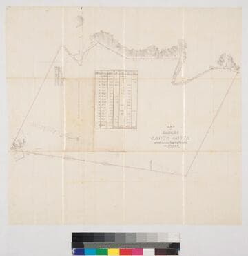
Map of Rancho Santa Anita
Manuscripts
Two tables of boundary data ; extensive surface detailing, structures, vegetation ; color highlighting. Alt. title supplied by cataloger.
mssSolano SR_Box_25(06).02

Precipice Cañon
Manuscripts
Sec. 2, 11, T. 1N. R. 12W. S. B. M. , meanders, showing surface detail; inset with table of courses & distances data, survey notations. Survey requested by J. Craig. Alt title supplied by cataloger.
mssSolano SR_Map_0177.01

Map showing land granted as right of way to the S.P.R.R. Co. colored red
Manuscripts
Tract of Land described in deed from Sister Mary Scholastica Logsdon to M.C. Desnoyers of Sept. 1868 by Lothar Seebold. Southern Pacific right of way and Desnoyers parcel along Alameda St. and new road to Arroyo Seco. Inset with table of courses & distances. Structures including Stearns Mill, Zanja. Alt title supplied by cataloger.
mssSolano SR_Map_0444